The tourist information about Lanzarote we wanted to have before traveling there.
Caldera de Montaña Blanca Hike
Hiking to Caldera Blanca will offer you a walk between the different types of lava and an amazing view to the caldera itself. I haven’t seen anything like this before. I think that this is one of the best things to do in Lanzarote (the other is visiting the Timanfaya National Park).
Important: This hike is a longer one and there is no place to buy anything along the path, so don’t forget to bring enough water and some snacks!
The Beginning
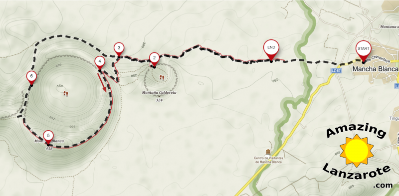
You can park your car on a small unofficial parking place (marked as END in the map bellow) after driving on dirt road for a few hundred meters. Or if your car rental agreement does not allow you to drive on the dirt roads, you can park in the village called Mancha Blanca. (marked as START in the map)
We parked in the village and walked from there. The path is called Camino al Cráter (literally Path to Crater). What I really liked is that along the path there are official information boards describing the history of the volcano as well as different aspects of geology. Although I can speak some Spanish, I was happy to read the English version because the texts about geology are no easy read :-)
Here is the map of the hike:
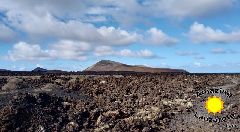
The hike starts by walking two or three kilometers through the volcanic landscape. During the walk, you can imagine that you are on the surface of the Moon. And be careful while looking over the lava fields, so you don’t stumble over some rocks, because the path is uneven. You are hiking the volcano terrain after all.
Montaña Caldereta
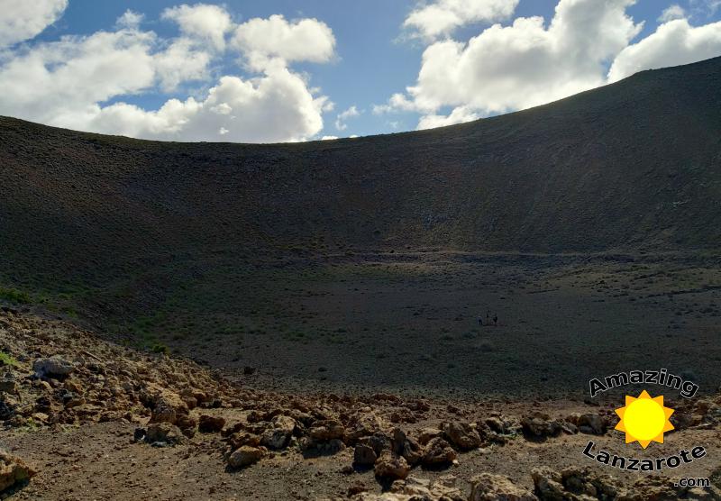
Then you will arrive to the smaller crater into which you can walk from the side (map point: 2). It is called Montaña Caldereta. Because the crater is well protected against wind and has higher humidity, it was used for growing crops and goat farming in the past.
Caldera de Montaña Blanca
After visiting Montaña Caldereta you will start to ascend (map point: 3) the edge of the Caldera Blanca. After you finish the climbing (it is not that hard after all), you will be astonished by the view. I bet. For a while we just stood there and watched (map point: 4).
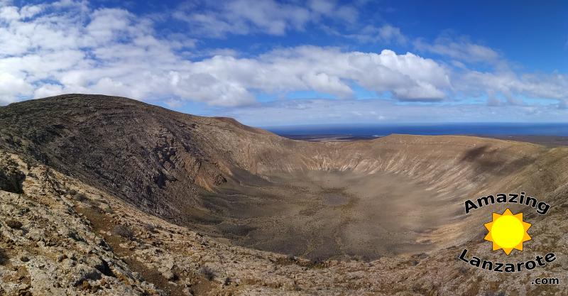
Next, I suggest that you circle the Caldera clockwise (I marked it in the map with an arrow). It is best to walk for a while and then stop and watch. I don’t recommend doing both at the same time, as the path leads along the very edge of the crater :-)
Then you will arrive to the highest point of the whole hike, to the summit of the Montaña Blanca itself. (map point: 5)
Going back
Even though I mentioned circling the crated, we actually didn’t do it. At one point (map point: 6) there path leading down, so we took that. It is not that easy to spot it, so don’t forget to consult the map. It is also marked by small towers from stones.
Following the map, you will soon be back on the main path and you will easily return back to the parking and home.
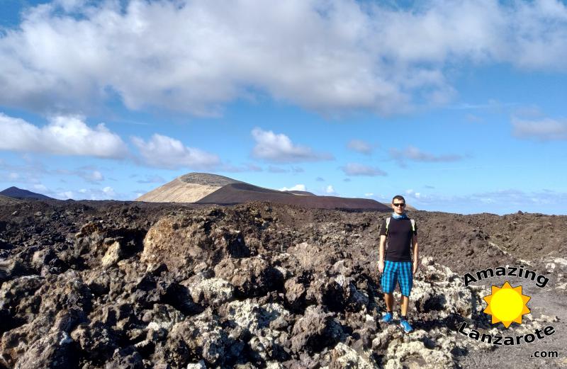
Hey, it’s me in the photo and both volcanoes in the background!
You can download the track-record (and GPX) from my Wikiloc